20/05/2024

Quieter times ahead overnight, storms return Wednesday

El pasado Martes 07

Quieter times ahead overnight, storms return Wednesday

Wednesday won't be a washout, but things could be noisy at times.

Wednesday won't be a washout, but things could be noisy at times.

ROCKFORD, Ill. (WIFR) - Things have taken a turn for the more active over the course of the past 24 hours in the Stateline.

As anticipated, Mother Nature has delivered three rounds of showers and thunderstorms to the Stateline, the first of which arriving early Tuesday morning, the second in the early afternoon, and now a third and final round of storms was sweeping through the region Tuesday evening.

Once the sun goes down, our atmosphere will stabilize quickly, and storms will likely collapse within a matter of minutes. Until then, though, storms may bring brief wind gusts of up to 60mph as well as quarter size hail.

Generally quiet conditions will then follow for the remainder of the overnight hours, with temperatures falling down to around 50°.

Clouds will be with us for a good part of Wednesday, though we won’t be entirely without sunshine. In fact, a good deal of mixed sun is likely, with temperatures set to reach the middle to upper 70s.

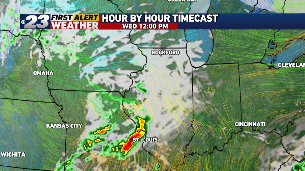
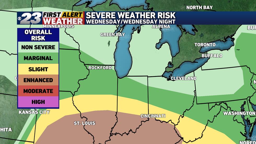
While a couple showers are possible here or there, the main severe weather show during the daytime Wednesday will be found well to the south, over central and southern Illinois.

Quiet conditions are likely to kick off our Wednesday.
Quiet conditions are likely to kick off our Wednesday.(Mark Henderson, WIFR)
Showers and storms are likely to develop downstate Wednesday afternoon.
Showers and storms are likely to develop downstate Wednesday afternoon.(Mark Henderson, WIFR)
Active storms are likely in central and southern Illinois Wednesday afternoon.
Active storms are likely in central and southern Illinois Wednesday afternoon.(Mark Henderson, WIFR)
More showers and storms are likely to our south Wednesday evening, but most of us stay dry,...
More showers and storms are likely to our south Wednesday evening, but most of us stay dry, aside from a few scattered showers.(Mark Henderson, WIFR)

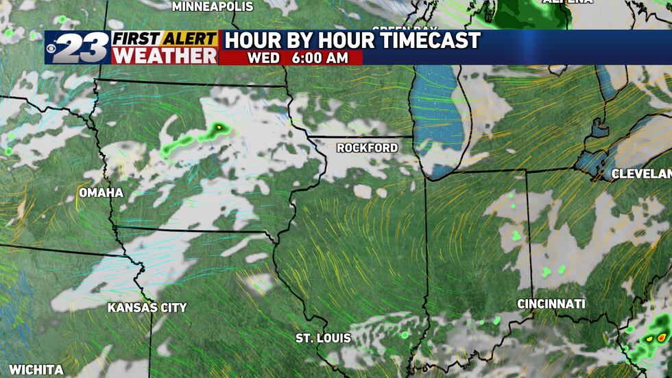
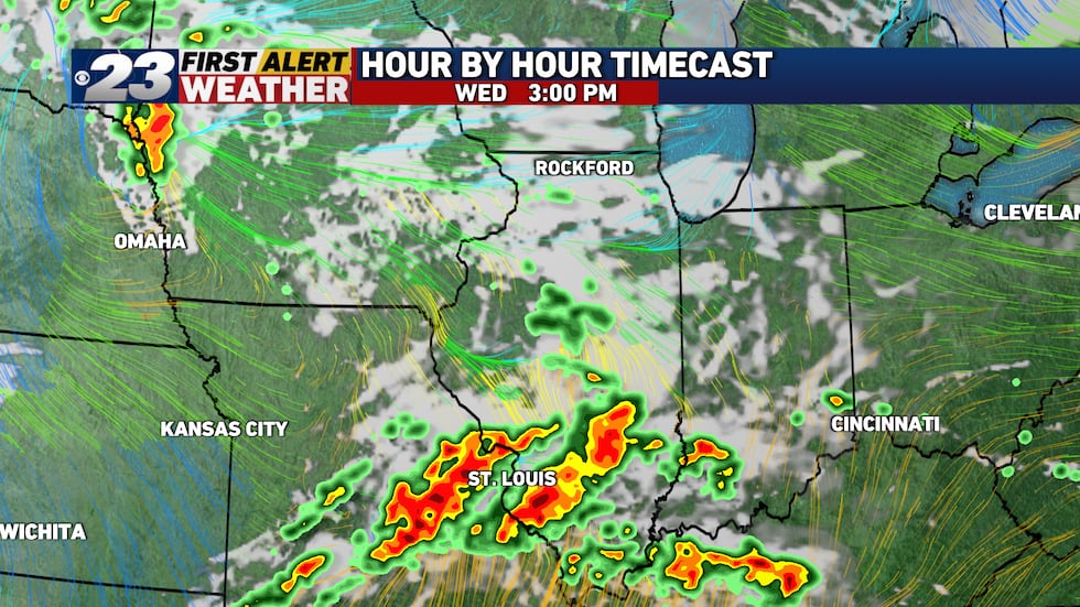
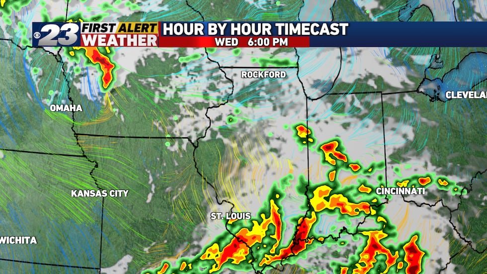
Here in the Stateline, our storm chances really don’t ramp up until the evening and overnight hours Wednesday, continuing into the early stages of Thursday morning. At this point, severe weather does not appear to be a significant concern, though a few storms may produce gusty winds and some hail.

Showers and storms will approach the Stateline late Wednesday night into early Thursday morning.
Showers and storms will approach the Stateline late Wednesday night into early Thursday morning.(Mark Henderson, WIFR)
Showers and storms are to become more likely here early Thursday morning.
Showers and storms are to become more likely here early Thursday morning.(Mark Henderson, WIFR)
Showers will persist into Thursday morning.
Showers will persist into Thursday morning.(Mark Henderson, WIFR)
There's a very low chance for severe weather Wednesday and Wednesday night here. Central and...
There's a very low chance for severe weather Wednesday and Wednesday night here. Central and Southern Illinois will have the best chances for severe weather by far.(Mark Henderson, WIFR)

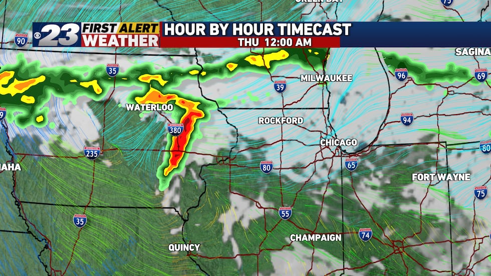
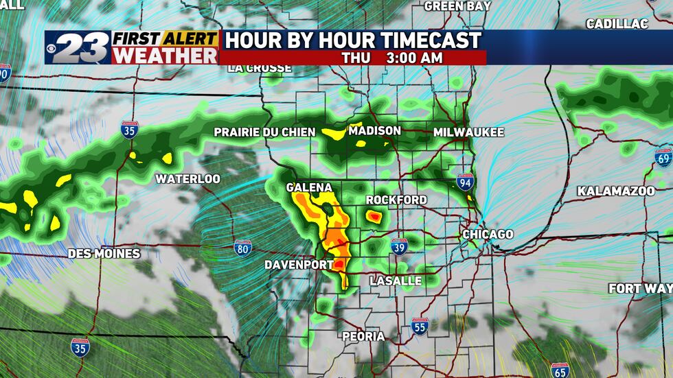
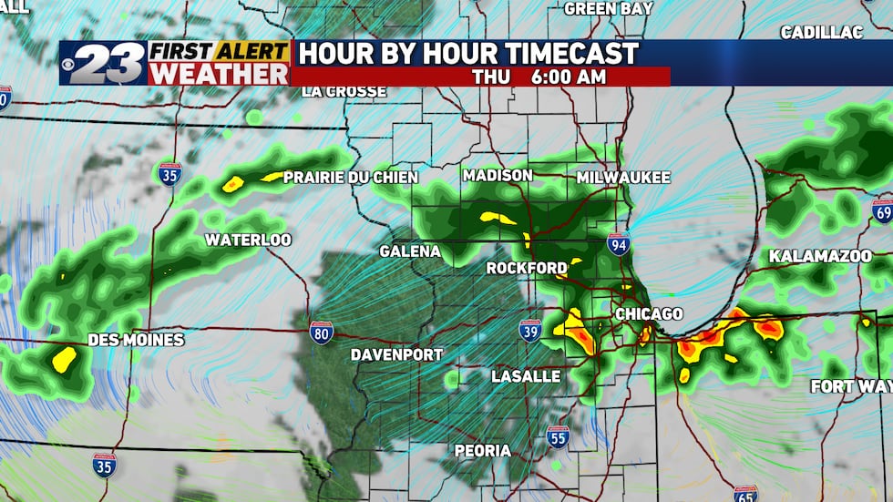
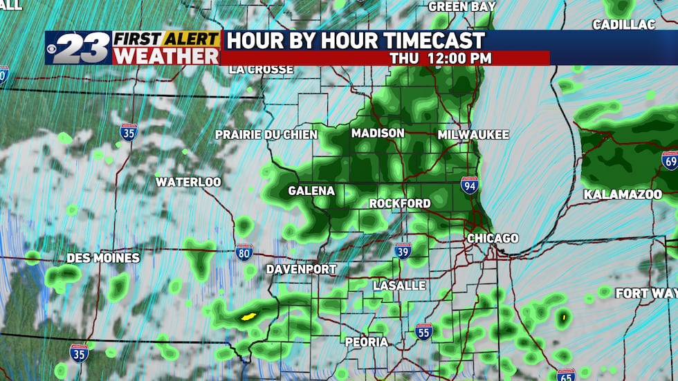
Rain will likely linger well into our Thursday, though our severe weather threat will have come to an end, as winds realign out of the northeast. That’ll keep our temperatures on the cooler side of things, which will help to stabilize our atmosphere. The end result here will be a rather gray, damp and dreary day with temperatures in the upper 50s to lower 60s.

A chilly rain will fall for much of Thursday.
A chilly rain will fall for much of Thursday.(Mark Henderson, WIFR)

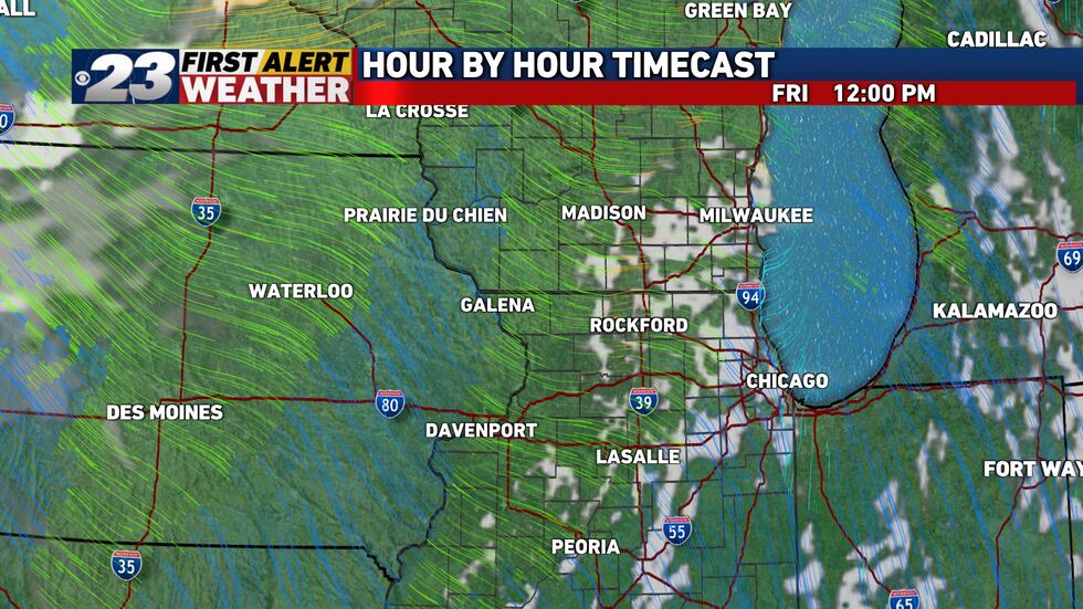
Friday’s to see the return of much more tranquil weather with sunshine in control and seasonable temperatures in the middle 60s.

Sunshine will mix with a few clouds Friday.
Sunshine will mix with a few clouds Friday.(Mark Henderson, WIFR)

Ver noticia en Trending

Temas Relacionados: